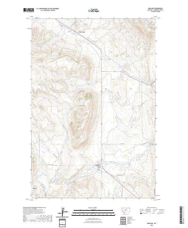
2024 Map of Ringling
USGS Topo · Published 2024About this map
Ringling serves as the primary hub of this high-altitude cattle country, situated where the high-plains geography meets the upper reaches of Sixteenmile Creek. This contemporary survey illustrates a landscape of large ranching operations and family-named landmarks, such as Horse Butte and the West Hogback ridge. To the north, the headwaters of the South Fork Smith River begin their journey near Moss Agate, while the southern reaches of the quadrangle include the settlement of Moyne and the meandering path of Meadow Creek. The grid of the Public Land Survey System defines the region into sections like t7n r7e, reflecting the orderly distribution of territory that remains visible in today's property boundaries and rural road network, including Sixteen Mile Rd and New Dorsey Rd.
Find a feature on this map
23 named features on this map. Tap any name to fly to it.
Don’t see what you’re looking for? This feature index may not catch every label — zoom into the map to look around manually.
Map Details
Editions of this 2024 Ringling Map
This is the sole edition of this map. No revisions or reprints were ever made.
Other maps of this area

1886 · Little Belt Mts.
USGS Topo · 1:250,000

1894 · Little Belt Mts.
USGS Topo · 1:250,000

1897 · Little Belt Mts.
USGS Topo · 1:250,000

1898 · Little Belt Mts.
USGS Topo · 1:250,000

1902 · Little Belt Mts.
USGS Topo · 1:250,000

1948 · White Sulphur Springs
USGS Topo · 1:250,000

1948 · Sixteen
USGS Topo · 1:24,000

1951 · Sixteen NE
USGS Topo · 1:24,000

1951 · Hamen
USGS Topo · 1:24,000
1951 · Wolf Hill
USGS Topo · 1:24,000