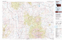
1993 Map of Ringling
USGS Topo · Published 1993About this map
Ringling and the surrounding high-country watersheds of the Smith River and Musselshell River define this 1993 topological study of the Meagher County region. The landscape is dominated by the massive rise of the Crazy Mountains and Castle Mountains, where the Lewis and Clark National Forest and Gallatin National Forest manage vast stretches of timbered terrain. Historically significant locations such as Castle Town and the Cumberland Mine point to the area's mineral heritage, while the presence of the Burlington Northern railroad route through Loweth and Bruno highlights the importance of rail transport in connecting these remote mountain settlements.
Find a feature on this map
78 named features on this map. Tap any name to fly to it.
Don’t see what you’re looking for? This feature index may not catch every label — zoom into the map to look around manually.
Map Details
Editions of this 1993 Ringling Map
This is the sole edition of this map. No revisions or reprints were ever made.
Other maps of this area

1886 · Fort Logan
USGS Topo · 1:250,000

1886 · Little Belt Mts.
USGS Topo · 1:250,000

1888 · Three Forks
USGS Topo · 1:250,000

1889 · Big Snowy Mountain
USGS Topo · 1:250,000

1891 · Livingston
USGS Topo · 1:250,000

1891 · Big Timber
USGS Topo · 1:125,000

1893 · Livingston
USGS Topo · 1:250,000

1893 · Big Snowy Mountain
USGS Topo · 1:250,000

1893 · Big Timber
USGS Topo · 1:125,000

1894 · Three Forks
USGS Topo · 1:250,000