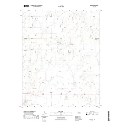
2018 Map of Ringwood
USGS Topo · Published 2018About this map
Ringwood and Meno anchor this 2018 survey of the Oklahoma plains, situated along a prominent east-west transportation corridor. The landscape is defined by a dense grid of section roads that navigate the subtle drainage basins of Turkey Cr, Hoyle Cr, and Elm Cr. These seasonal waterways cut through the terrain, creating localized depressions like Koehn Lake and Indian Cr that break up the agricultural pattern.
Find a feature on this map
49 named features on this map. Tap any name to fly to it.
Don’t see what you’re looking for? This feature index may not catch every label — zoom into the map to look around manually.
Map Details
Editions of this 2018 Ringwood Map
This is the sole edition of this map. No revisions or reprints were ever made.
Other maps of this area

1955 · Woodward
USGS Topo · 1:250,000

1956 · Ringwood
USGS Topo · 1:62,500

1958 · Woodward
USGS Topo · 1:250,000

1969 · Goltry
USGS Topo · 1:24,000

1969 · Fairview NE
USGS Topo · 1:24,000

1969 · Helena
USGS Topo · 1:24,000

1969 · Fairview SE
USGS Topo · 1:24,000

1969 · Jet SE
USGS Topo · 1:24,000
1982 · Ringwood
USGS Topo · 1:24,000
1982 · Ringwood SW
USGS Topo · 1:24,000