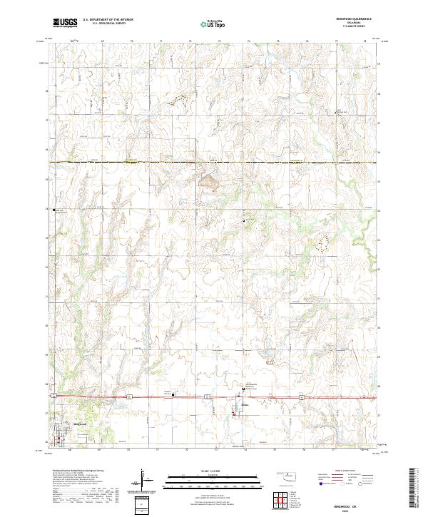
2022 Map of Ringwood
USGS Topo · Published 2022About this map
Ringwood and Meno anchor this rural section of Oklahoma, where the flat agricultural plains are divided by a precise grid of section-line roads such as e0380 RD and n2700 RD. The landscape is defined by its agrarian roots and religious heritage, evidenced by the cluster of cemeteries that serve these prairie communities, including New Hopedale Mennonite Memorial Cem and Saint Michael Cem. A network of small waterways, most notably Turkey Cr and Hoyle Cr, meander through the countryside, while Koehn Lake provides a distinct hydrological feature in the central portion of the survey area. The mapping of Decker Field near the southern boundary suggests localized infrastructure in an otherwise expansive landscape of homesteads and fields. This survey provides a clear look at the spatial organization of Major Co and Alfalfa Co, showing how local life is organized around these small town centers and their surrounding cemeteries and creek beds.
Find a feature on this map
35 named features on this map. Tap any name to fly to it.
Don’t see what you’re looking for? This feature index may not catch every label — zoom into the map to look around manually.
Map Details
Editions of this 2022 Ringwood Map
This is the sole edition of this map. No revisions or reprints were ever made.
Other maps of this area

1955 · Woodward
USGS Topo · 1:250,000

1956 · Ringwood
USGS Topo · 1:62,500

1958 · Woodward
USGS Topo · 1:250,000

1969 · Goltry
USGS Topo · 1:24,000

1969 · Fairview NE
USGS Topo · 1:24,000

1969 · Helena
USGS Topo · 1:24,000

1969 · Fairview SE
USGS Topo · 1:24,000

1969 · Jet SE
USGS Topo · 1:24,000
1982 · Ringwood
USGS Topo · 1:24,000
1982 · Ringwood SW
USGS Topo · 1:24,000