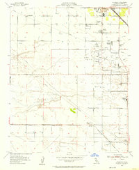
1954 Map of Rio Bravo
USGS Topo · Published 1957About this map
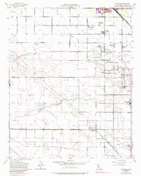
The Rio Bravo Oil Field dominates the central landscape of this 1954 survey, illustrating the industrial footprint of petroleum extraction in the San Joaquin Valley. Clusters of oil wells and tanks surround the intersection of Imperial Street and Seventh Standard Road, while a dense network of pipelines traverses the flat terrain. This mid-century view captures a unique social geography, where labor-focused settlements like the Mexican Colony, Cherokee Strip, and Farm Labor Center sit adjacent to the bustling agricultural and rail hub of Shafter.
Find a feature on this map
27 named features on this map. Tap any name to fly to it.
Don’t see what you’re looking for? This feature index may not catch every label — zoom into the map to look around manually.
Map Details
Editions of this 1954 Rio Bravo Map
5 editions found
Other maps of this area

1910 · Buena Vista Lake
USGS Topo · 1:125,000

1912 · Buena Vista Lake
USGS Topo · 1:125,000

1929 · Stevens
USGS Topo · 1:31,680

1929 · Coles Levee
USGS Topo · 1:31,680

1930 · Leonards
USGS Topo · 1:31,680

1930 · Wasco
USGS Topo · 1:31,680

1930 · Famoso
USGS Topo · 1:31,680

1930 · Rosedale
USGS Topo · 1:31,680

1931 · Rio Bravo
USGS Topo · 1:31,680

1932 · East Elk Hills
USGS Topo · 1:31,680