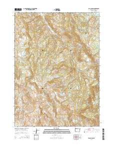
2014 Map of Rio Canyon
USGS Topo · Published 2014About this map
Rio Canyon and the high-elevation drainage basins of Jackson County define this 2014 survey, highlighting a landscape managed for water storage and rugged backcountry access. The northern portion of the map is punctuated by several significant water bodies, including Bradshaw Reservoir Number Two, Lake Creek Reservoir, and Nugren Reservoir. These features, along with smaller catchments like Pierce Reservoir and Wertz Reservoirs, suggest a complex network of resource management and local irrigation infrastructure.
Find a feature on this map
40 named features on this map. Tap any name to fly to it.
Don’t see what you’re looking for? This feature index may not catch every label — zoom into the map to look around manually.
Map Details
Editions of this 2014 Rio Canyon Map
This is the sole edition of this map. No revisions or reprints were ever made.
Other maps of this area

1891 · Ashland
USGS Topo · 1:250,000

1893 · Ashland
USGS Topo · 1:250,000

1897 · Ashland
USGS Topo · 1:250,000

1938 · Medford
USGS Topo · 1:125,000

1954 · Medford
USGS Topo · 1:62,500

1954 · Lakecreek
USGS Topo · 1:62,500

1954 · Talent
USGS Topo · 1:62,500

1954 · Ashland
USGS Topo · 1:62,500

1955 · Medford
USGS Topo · 1:250,000

1957 · Medford
USGS Topo · 1:250,000