2022 Map of Rio
USGS Topo · Published 2022About this map
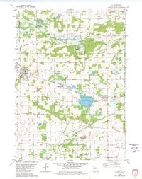
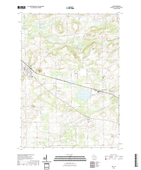
Rio serves as a primary rail and road hub in this corner of Columbia County, where a network of town streets like Union St and Roosevelt St meet the corridor of Co Hwy B. The landscape is defined by its glaciated hydrology, featuring numerous kettle ponds and wetlands such as Hawkos Pond, Grassy Lake, and the meandering N Br Crawfish River. Local history is anchored by a significant distribution of rural burial grounds, including Ohio Cem, Saint Joseph's Catholic Cem, and the Bonnet Prairie Cem. Smaller clusters of settlement appear at Doylestown and Otsego, the latter situated near the confluence of the river and local routes like King Rd. The presence of Higgins Airport and Willow Mill Pond further illustrates the mixed use of this agricultural and wetland terrain.
Find a feature on this map
83 named features on this map. Tap any name to fly to it.
Don’t see what you’re looking for? This feature index may not catch every label — zoom into the map to look around manually.
Map Details
Editions of this 2022 Rio Map
This is the sole edition of this map. No revisions or reprints were ever made.