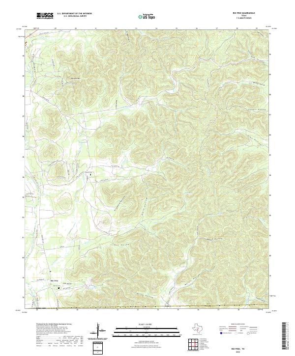
2022 Map of Rio Frio
USGS Topo · Published 2022About this map
The unincorporated settlement of Rio Frio anchors the southwestern corner of this survey, situated near the confluence of the Frio River and Little Dry Frio Cr. This rugged stretch of the Texas Hill Country is defined by a dense network of canyons and hollows, where family-named landmarks like Grigsby Canyon and Bailey Hollow suggest generations of ranching history. Genealogical interest is centered on the Rio Frio Cem and the more remote Chisum Cem tucked near the base of Saddle Mountain.
Find a feature on this map
63 named features on this map. Tap any name to fly to it.
Don’t see what you’re looking for? This feature index may not catch every label — zoom into the map to look around manually.
Map Details
Editions of this 2022 Rio Frio Map
This is the sole edition of this map. No revisions or reprints were ever made.
Other maps of this area

1954 · San Antonio
USGS Topo · 1:250,000

1956 · Utopia
USGS Topo · 1:62,500

1957 · San Antonio
USGS Topo · 1:250,000

1957 · York Hollow
USGS Topo · 1:62,500

1960 · Magers Crossing
USGS Topo · 1:24,000

1964 · Circle Bluff
USGS Topo · 1:24,000

1964 · Sabinal Canyon
USGS Topo · 1:24,000
1969 · Vanderpool
USGS Topo · 1:24,000
1969 · Utopia
USGS Topo · 1:24,000
1969 · Rio Frio
USGS Topo · 1:24,000