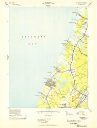
1944 Map of Rio Grande
USGS Topo · Published 1944About this map
Wildwood US Naval Air Station dominates the southern landscape of this Cape May County survey, reflecting the wartime mobilization of the mid-1940s. Along the coast of Delaware Bay, a string of small landings and shore communities like Villas, Del Haven, and Reeds Beach are connected by the Shore Road. Further inland, the map captures the transition from marshy wetlands to established rural settlements such as Rio Grande and Nummytown. Transport infrastructure is critical to the region, evidenced by the Pennsylvania Reading Seashore Lines cutting through the interior and landmarks such as the Wildwood Pumping Sta. Local social foundations are noted at the Fishing Creek School, while specialized coastal industries are hinted at by King Crab Ldg. The survey detail also traces historic family-named paths like Shun Pike and Indian Trail Road.
Find a feature on this map
56 named features on this map. Tap any name to fly to it.
Don’t see what you’re looking for? This feature index may not catch every label — zoom into the map to look around manually.
Map Details
Editions of this 1944 Rio Grande Map
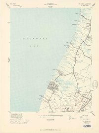
2 editions found
Other maps of this area

1888 · Cape May
USGS Topo · 1:62,500

1888 · Dennisville
USGS Topo · 1:62,500

1890 · Maurice Cove
USGS Topo · 1:62,500

1891 · Maurice Cove
USGS Topo · 1:62,500

1893 · Cape May
USGS Topo · 1:62,500

1894 · Dennisville
USGS Topo · 1:62,500

1898 · Cape May
USGS Topo · 1:62,500

1899 · Vineland
USGS Topo · 1:125,000

1918 · Cape Henlopen
USGS Topo · 1:62,500

1918 · Cape May
USGS Topo · 1:62,500
Featured Places
- Lower Township, NJ
- Middle Township, NJ
- Villas, Lower Township
- Kimseytown, Lower Township
- King Crab Landing, Middle Township