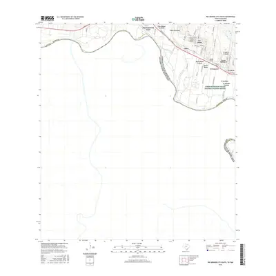
2016 Map of Rio Grande City South
USGS Topo · Published 2016About this map
Rio Grande City and its surrounding colonias are situated along the sweeping northern banks of the Rio Grande in southern Starr County. This borderland landscape is characterized by a dense network of residential developments and rural colonias such as Las Lomas, Santa Rosa, and Valle Hermoso, which sit just north of the Lower Rio Grande Valley National Wildlife Refuge. The map details the transition from the city center to the surrounding agricultural and residential settlements, where Los Olmos Cr meets the river. Significant local landmarks include the Olmos Cem and several named subdivisions like Garza-Salinas II and B and E Colonia. The survey reveals a complex residential grid that has expanded away from the historic river crossing, following roads like 83 and E Main St through the scrublands of south Texas.
Find a feature on this map
56 named features on this map. Tap any name to fly to it.
Don’t see what you’re looking for? This feature index may not catch every label — zoom into the map to look around manually.
Map Details
Editions of this 2016 Rio Grande City South Map
This is the sole edition of this map. No revisions or reprints were ever made.
Other maps of this area

1949 · Mc Allen
USGS Topo · 1:250,000

1954 · McAllen
USGS Topo · 1:250,000

1956 · Garcias
USGS Topo · 1:62,500

1956 · Los Ebanos
USGS Topo · 1:62,500

1956 · Escobares
USGS Topo · 1:62,500

1957 · Mc Allen
USGS Topo · 1:250,000

1962 · McAllen
USGS Topo · 1:250,000

1965 · Rio Grande City South
USGS Topo · 1:24,000

1965 · Los Garzas
USGS Topo · 1:24,000

1965 · La Grulla
USGS Topo · 1:24,000