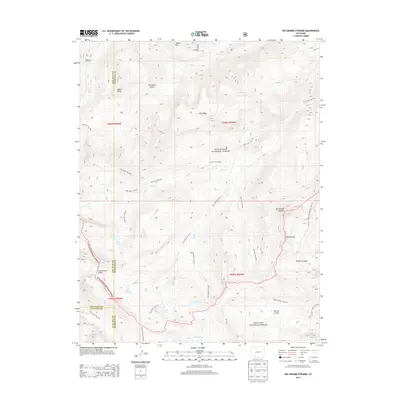
2013 Map of Rio Grande Pyramid
USGS Topo · Published 2013About this map
The Continental Divide bisects this high-elevation landscape, where the headwaters of the Rio Grande emerge among the ridges of the Rio Grande National Forest and San Juan National Forest. The geography is defined by prominent landmarks such as the Rio Grande Pyramid and the distinct pass known as The Window. This region lacks permanent settlements, instead being defined by a dense network of backcountry routes used for high-altitude traverse. Trails like Beartown Trail 869 and Ute Creek Trail 819 link remote water features including Ute Lake, Black Lake, and the Flint Lakes. The complex intersection of San Juan, Hinsdale, and La Plata counties occurs here, marking a rugged meeting point where names like Starvation Gulch and Rincon La Vaca reflect the historical realities of early mountain transit and livestock grazing.
Find a feature on this map
39 named features on this map. Tap any name to fly to it.
Don’t see what you’re looking for? This feature index may not catch every label — zoom into the map to look around manually.
Map Details
Editions of this 2013 Rio Grande Pyramid Map
This is the sole edition of this map. No revisions or reprints were ever made.
Other maps of this area

1897 · Silverton
USGS Topo · 1:62,500

1900 · Needle Mountains
USGS Topo · 1:62,500

1901 · Silverton
USGS Topo · 1:62,500

1902 · Needle Mountains
USGS Topo · 1:62,500

1902 · Silverton
USGS Topo · 1:62,500

1905 · San Cristobal
USGS Topo · 1:125,000

1907 · San Cristobal
USGS Topo · 1:125,000

1945 · Durango
USGS Topo · 1:250,000

1953 · Durango
USGS Topo · 1:250,000

1954 · Durango
USGS Topo · 1:250,000