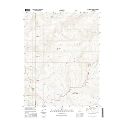
2016 Map of Rio Grande Pyramid
USGS Topo · Published 2016About this map
The Rio Grande Pyramid rises as a prominent landmark within the high-elevation wilderness where the Rio Grande National Forest and San Juan National Forest meet. This 2016 survey highlights the complex drainage system at the headwaters of the Rio Grande, including Sweetwater Creek and the various branches of Ute Creek. A dense network of paths, such as the Beartown Trail, Ute Trail, and the Continental Divide National Scenic Trail, navigates the difficult terrain of the Continental Divide. Prominent geological features like The Window and Rincon La Vaca define the landscape, while numerous alpine water bodies including Ute Lake, Flint Lakes, and Annie Lakes are scattered throughout the basins. The map illustrates a region dedicated to conservation and backcountry recreation, preserved through its inclusion in two national forests across the boundaries of La Plata, San Juan, and Hinsdale counties.
Find a feature on this map
42 named features on this map. Tap any name to fly to it.
Don’t see what you’re looking for? This feature index may not catch every label — zoom into the map to look around manually.
Map Details
Editions of this 2016 Rio Grande Pyramid Map
This is the sole edition of this map. No revisions or reprints were ever made.
Other maps of this area

1897 · Silverton
USGS Topo · 1:62,500

1900 · Needle Mountains
USGS Topo · 1:62,500

1901 · Silverton
USGS Topo · 1:62,500

1902 · Needle Mountains
USGS Topo · 1:62,500

1902 · Silverton
USGS Topo · 1:62,500

1905 · San Cristobal
USGS Topo · 1:125,000

1907 · San Cristobal
USGS Topo · 1:125,000

1945 · Durango
USGS Topo · 1:250,000

1953 · Durango
USGS Topo · 1:250,000

1954 · Durango
USGS Topo · 1:250,000