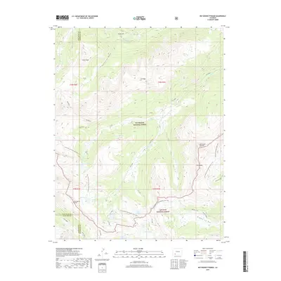
2019 Map of Rio Grande Pyramid
USGS Topo · Published 2019About this map
Rio Grande Pyramid dominates this high-altitude landscape where the Continental Divide separates the headwaters of the Rio Grande from the San Juan River basin. The terrain is a complex of high ridges and alpine basins, featuring prominent landmarks like The Window and the deep drainage of Starvation Gulch. The map records a dense network of high-country water bodies, including Ute Lake, Twin Lakes, and the Flint Lakes, which sit at the heart of the San Juan National Forest.
Find a feature on this map
44 named features on this map. Tap any name to fly to it.
Don’t see what you’re looking for? This feature index may not catch every label — zoom into the map to look around manually.
Map Details
Editions of this 2019 Rio Grande Pyramid Map
This is the sole edition of this map. No revisions or reprints were ever made.
Other maps of this area

1897 · Silverton
USGS Topo · 1:62,500

1900 · Needle Mountains
USGS Topo · 1:62,500

1901 · Silverton
USGS Topo · 1:62,500

1902 · Needle Mountains
USGS Topo · 1:62,500

1902 · Silverton
USGS Topo · 1:62,500

1905 · San Cristobal
USGS Topo · 1:125,000

1907 · San Cristobal
USGS Topo · 1:125,000

1945 · Durango
USGS Topo · 1:250,000

1953 · Durango
USGS Topo · 1:250,000

1954 · Durango
USGS Topo · 1:250,000