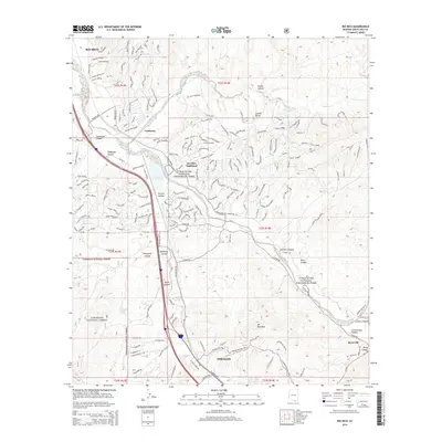
2014 Map of Rio Rico
USGS Topo · Published 2014About this map
The Santa Cruz River valley near the international border serves as the primary corridor for settlement and transportation in this 2014 survey. The community of Rio Rico and its neighbor Rio Rico Southeast dominate the northern portion of the sheet, where residential streets like Camino Magnifico and Avenida Gandara wind through the arid terrain. To the south, the city of Nogales borders the northern reaches of the Coronado National Forest, with Beyerville situated near the eastern edge.
Find a feature on this map
193 named features on this map. Tap any name to fly to it.
Don’t see what you’re looking for? This feature index may not catch every label — zoom into the map to look around manually.
Map Details
Editions of this 2014 Rio Rico Map
This is the sole edition of this map. No revisions or reprints were ever made.
Other maps of this area

1904 · Patagonia
USGS Topo · 1:125,000

1905 · Patagonia
USGS Topo · 1:125,000

1905 · Nogales
USGS Topo · 1:125,000

1920 · Arivaca
USGS Topo · 1:125,000

1921 · Old Glory
USGS Topo · 1:125,000

1922 · Agus Caliente
USGS Topo · 1:62,500

1933 · Calabasas
USGS Topo · 1:62,500

1939 · Tubac
USGS Topo · 1:62,500

1942 · Ruby
USGS Topo · 1:62,500

1943 · Old Glory
USGS Topo · 1:125,000