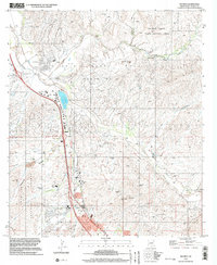
1996 Map of Rio Rico
USGS Topo · Published 2003About this map
Mt Benedict overlooks a landscape defined by mining history and the vital waters of the Santa Cruz River in this mid-1990s record of southern Arizona. The terrain is marked by a cluster of workings including the Columbia Mine, Gold Hill Mine, and Two Brothers Mine, indicating the region's long-standing connection to mineral extraction. Near the confluence of Sonoita Creek and the river, the settlement of Rio Rico is shown alongside the historic Calabasas (Site), highlighting the layers of human occupation in this corridor.
Find a feature on this map
38 named features on this map. Tap any name to fly to it.
Don’t see what you’re looking for? This feature index may not catch every label — zoom into the map to look around manually.
Map Details
Editions of this 1996 Rio Rico Map
This is the sole edition of this map. No revisions or reprints were ever made.
Other maps of this area

1904 · Patagonia
USGS Topo · 1:125,000

1905 · Patagonia
USGS Topo · 1:125,000

1905 · Nogales
USGS Topo · 1:125,000

1920 · Arivaca
USGS Topo · 1:125,000

1921 · Old Glory
USGS Topo · 1:125,000

1922 · Agus Caliente
USGS Topo · 1:62,500

1933 · Calabasas
USGS Topo · 1:62,500

1939 · Tubac
USGS Topo · 1:62,500

1942 · Ruby
USGS Topo · 1:62,500

1943 · Old Glory
USGS Topo · 1:125,000