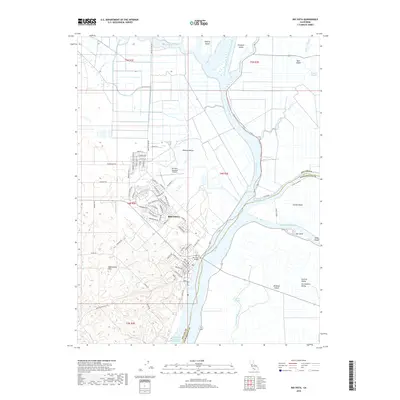
2018 Map of Rio Vista
USGS Topo · Published 2018About this map
Rio Vista sits at a critical junction in the California Delta, where the Sacramento River meets a complex network of sloughs and reclaimed island tracts. The 2018 landscape is defined by the contrast between the elevated Montezuma Hills to the west and the low-lying agricultural basins of Grand Island and Brannan Island to the east. This period shows the continued importance of maritime infrastructure, specifically the Sacramento River Deep Water Ship Channel and the Rio Vista Bridge connecting Solano Co and Sacramento Co. The map documents the residential expansion of the town, including neighborhoods around Saint Andrews Dr and Summerset Dr, while maintaining traditional landmarks like the Rio Vista Municipal Airport. Waterways such as Cache Slough and Steamboat Slough illustrate the intricate drainage and transport system that has shaped this region of the Central Valley for over a century.
Find a feature on this map
79 named features on this map. Tap any name to fly to it.
Don’t see what you’re looking for? This feature index may not catch every label — zoom into the map to look around manually.
Map Details
Editions of this 2018 Rio Vista Map
This is the sole edition of this map. No revisions or reprints were ever made.
Other maps of this area

1907 · Antioch
USGS Topo · 1:62,500

1908 · Vacaville
USGS Topo · 1:62,500

1908 · Courtland
USGS Topo · 1:62,500

1908 · Antioch
USGS Topo · 1:62,500

1910 · Rio Vista
USGS Topo · 1:31,680

1910 · Bouldin
USGS Topo · 1:31,680

1910 · Jersey
USGS Topo · 1:31,680

1910 · Isleton
USGS Topo · 1:31,680

1916 · Cache Slough
USGS Topo · 1:31,680

1916 · Vorden
USGS Topo · 1:31,680