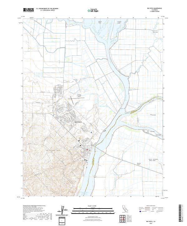
2022 Map of Rio Vista
USGS Topo · Published 2022About this map
Rio Vista sits at the eastern edge of the Montezuma Hills, overseeing the complex transition where the Sacramento River meets the expansive labyrinth of the Sacramento-San Joaquin Delta. This modern survey illustrates the intricate network of waterways defining the region, from the primary Sacramento River Deep Water Ship Channel to secondary channels like Cache Slough and Steamboat Slough. The landscape is a patchwork of reclaimed tracts including Grand Island, Ryer Island, and Liberty Island, which reflect a century of hydrologic engineering and agricultural development in the Sacramento Valley. Local history and genealogy interest is concentrated around the town's core, featuring the Rio Vista Municipal Airport and the neighboring Rio Vista Cem and Rio Vista Catholic Cem. The surrounding terrain transitions abruptly from the rolling elevations of Watson Hollow to the flat, river-carved lowlands.
Find a feature on this map
86 named features on this map. Tap any name to fly to it.
Don’t see what you’re looking for? This feature index may not catch every label — zoom into the map to look around manually.
Map Details
Editions of this 2022 Rio Vista Map
This is the sole edition of this map. No revisions or reprints were ever made.
Other maps of this area

1907 · Antioch
USGS Topo · 1:62,500

1908 · Vacaville
USGS Topo · 1:62,500

1908 · Courtland
USGS Topo · 1:62,500

1908 · Antioch
USGS Topo · 1:62,500

1910 · Rio Vista
USGS Topo · 1:31,680

1910 · Bouldin
USGS Topo · 1:31,680

1910 · Jersey
USGS Topo · 1:31,680

1910 · Isleton
USGS Topo · 1:31,680

1916 · Cache Slough
USGS Topo · 1:31,680

1916 · Vorden
USGS Topo · 1:31,680