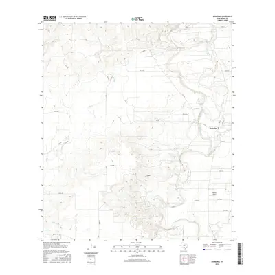
2016 Map of Riomedina
USGS Topo · Published 2016About this map
The Medina River snakes through the eastern portion of this landscape, anchoring the settlement of Riomedina. This 2016 survey illustrates a ranching and rural residential environment where water sources define the geography, from the named Haby 1 Springs and Haby 2 Springs to the numerous drainage systems like Quihi Cr and Opossum Cr. The terrain is punctuated by Indian Hill, a prominent rise overlooking the confluence of small creeks and the river valley.
Find a feature on this map
51 named features on this map. Tap any name to fly to it.
Don’t see what you’re looking for? This feature index may not catch every label — zoom into the map to look around manually.
Map Details
Editions of this 2016 Riomedina Map
This is the sole edition of this map. No revisions or reprints were ever made.
Other maps of this area

1954 · San Antonio
USGS Topo · 1:250,000

1956 · New Fountain
USGS Topo · 1:62,500

1956 · Bandera
USGS Topo · 1:62,500

1956 · Medina Lake
USGS Topo · 1:62,500

1957 · San Antonio
USGS Topo · 1:250,000

1958 · La Coste
USGS Topo · 1:24,000

1958 · La Coste NE
USGS Topo · 1:24,000

1964 · Riomedina
USGS Topo · 1:24,000

1964 · Castroville
USGS Topo · 1:24,000

1964 · Timber Creek
USGS Topo · 1:24,000