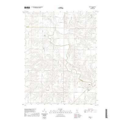
2021 Map of Ripley
USGS Topo · Published 2021About this map
The La Moine River meanders across this landscape on the border of Schuyler and Brown counties, carving a deep valley that defines the local geography. The village of Ripley is situated in the southeastern corner, serving as a focal point for the surrounding rural area. High ground is found at Dutch Ridge, which overlooks the various tributaries like Shelby Cr and Missouri Cr that feed into the main river system.
Find a feature on this map
72 named features on this map. Tap any name to fly to it.
Don’t see what you’re looking for? This feature index may not catch every label — zoom into the map to look around manually.
Map Details
Editions of this 2021 Ripley Map
This is the sole edition of this map. No revisions or reprints were ever made.
Other maps of this area

1923 · Rushville
USGS Topo · 1:62,500

1926 · Rushville
USGS Topo · 1:62,500

1926 · Mt Sterling
USGS Topo · 1:62,500

1928 · Meredosia
USGS Topo · 1:62,500

1929 · Mt Sterling
USGS Topo · 1:62,500

1931 · Meredosia
USGS Topo · 1:62,500

1946 · Augusta
USGS Topo · 1:62,500

1948 · Quincy
USGS Topo · 1:250,000

1949 · Augusta
USGS Topo · 1:62,500

1956 · Quincy
USGS Topo · 1:250,000