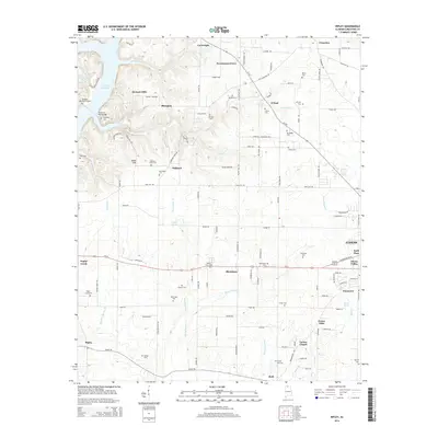
2014 Map of Ripley
USGS Topo · Published 2014About this map
The Wheeler Reservoir defines the northwestern edge of this Limestone County landscape, where the Tennessee River's influence reaches into the surrounding hills and valleys. Small settlements and family hamlets such as Shanghai, Oakland, and Blackburn are connected by a network of rural roads, including the historical corridor of Al-99. The area is notably dense with small burial grounds and family plots, including Mt Pisgah Cem, Pleasant Point Cem, and McKinney Cem, which offer significant value for genealogical research and local history documentation.
Find a feature on this map
132 named features on this map. Tap any name to fly to it.
Don’t see what you’re looking for? This feature index may not catch every label — zoom into the map to look around manually.
Map Details
Editions of this 2014 Ripley Map
This is the sole edition of this map. No revisions or reprints were ever made.
Other maps of this area

1888 · Huntsville
USGS Topo · 1:125,000

1892 · Huntsville
USGS Topo · 1:125,000

1935 · Athens
USGS Topo · 1:24,000

1936 · Union Hill
USGS Topo · 1:24,000

1936 · Stewart Cross Roads
USGS Topo · 1:24,000

1936 · Elkmont
USGS Topo · 1:24,000

1936 · Ripley
USGS Topo · 1:24,000

1936 · Hillsboro
USGS Topo · 1:24,000

1936 · Tanner
USGS Topo · 1:24,000

1936 · Cairo
USGS Topo · 1:24,000