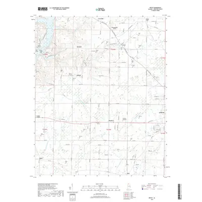
2018 Map of Ripley
USGS Topo · Published 2018About this map
Round Island Creek and its many tributaries, including Beauchamp Branch and Britnell Branch, define the rural character of this northern Alabama landscape northwest of Athens. The map reveals a dense network of family and community landmarks, particularly evident in the high concentration of burial sites such as Mount Pisgah Cemetery, Yarbrough Cemetery, and the Limestone Presbyterian Church Cemetery. Small, dispersed settlements like Shanghai, Persimmon Grove, and Cross Key are connected by a web of established routes including Easter Ferry Road and Buck Island Road. To the west, the topography shifts near Wheeler Reservoir, where Dog Hollow and Baker Hill overlook the winding Cairo Branch. The inclusion of the Elk River Mills Bridge points to the historical importance of river crossings and local milling in the area's development.
Find a feature on this map
140 named features on this map. Tap any name to fly to it.
Don’t see what you’re looking for? This feature index may not catch every label — zoom into the map to look around manually.
Map Details
Editions of this 2018 Ripley Map
This is the sole edition of this map. No revisions or reprints were ever made.
Other maps of this area

1888 · Huntsville
USGS Topo · 1:125,000

1892 · Huntsville
USGS Topo · 1:125,000

1935 · Athens
USGS Topo · 1:24,000

1936 · Union Hill
USGS Topo · 1:24,000

1936 · Stewart Cross Roads
USGS Topo · 1:24,000

1936 · Elkmont
USGS Topo · 1:24,000

1936 · Ripley
USGS Topo · 1:24,000

1936 · Hillsboro
USGS Topo · 1:24,000

1936 · Tanner
USGS Topo · 1:24,000

1936 · Cairo
USGS Topo · 1:24,000