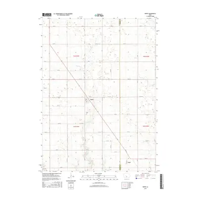
2015 Map of Rippey
USGS Topo · Published 2015About this map
Rippey serves as the central hub of this agricultural landscape in southeastern Greene County, where the town layout is defined by a grid including Percival St and 2nd St. To the south lies the small community of Angus, situated near the border with Boone County. The terrain is characterized by a series of winding watercourses, most notably Snake Cr, which meanders past the Rippey Cem before continuing southward. Other drainage systems like Parrish Branch and Frog Cr define the local topography, shaping the placement of the extensive township road network. This network, consisting of many lettered avenues such as Xavier Ave and W Ave, illustrates the systematic organization of Iowa farmland and the vital connections between these rural settlements.
Find a feature on this map
47 named features on this map. Tap any name to fly to it.
Don’t see what you’re looking for? This feature index may not catch every label — zoom into the map to look around manually.
Map Details
Editions of this 2015 Rippey Map
This is the sole edition of this map. No revisions or reprints were ever made.
Other maps of this area

1950 · Perry
USGS Topo · 1:62,500

1951 · Perry
USGS Topo · 1:62,500

1951 · Ogden
USGS Topo · 1:62,500

1954 · Bagley
USGS Topo · 1:62,500

1954 · Omaha
USGS Topo · 1:250,000

1954 · Fort Dodge
USGS Topo · 1:250,000

1957 · Omaha
USGS Topo · 1:250,000

1957 · Fort Dodge
USGS Topo · 1:250,000

1958 · Omaha
USGS Topo · 1:250,000

1958 · Fort Dodge
USGS Topo · 1:250,000