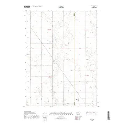
2018 Map of Rippey
USGS Topo · Published 2018About this map
The town of Rippey serves as the central hub of this agricultural landscape in southeastern Greene County, defined by a rigid grid of country roads and the meandering courses of local waterways. Settled within Washington Township, the community is anchored by local landmarks including the Po and the nearby Rippey Cem to the south. The terrain is drained by a network of small streams, most notably Snake Cr, Parrish Br, and Jim Cr, which break the geometric precision of the section lines. Near the southern border at the intersection of the Greene and Boone County line, the small settlement of Angus marks a point of historical transition. This 2018 survey illustrates the enduring patterns of rural Iowa land use, where the placement of farmsteads and cemeteries like Rippey Cem preserves the footprints of generations of local families.
Find a feature on this map
32 named features on this map. Tap any name to fly to it.
Don’t see what you’re looking for? This feature index may not catch every label — zoom into the map to look around manually.
Map Details
Editions of this 2018 Rippey Map
This is the sole edition of this map. No revisions or reprints were ever made.
Other maps of this area

1950 · Perry
USGS Topo · 1:62,500

1951 · Perry
USGS Topo · 1:62,500

1951 · Ogden
USGS Topo · 1:62,500

1954 · Bagley
USGS Topo · 1:62,500

1954 · Omaha
USGS Topo · 1:250,000

1954 · Fort Dodge
USGS Topo · 1:250,000

1957 · Omaha
USGS Topo · 1:250,000

1957 · Fort Dodge
USGS Topo · 1:250,000

1958 · Omaha
USGS Topo · 1:250,000

1958 · Fort Dodge
USGS Topo · 1:250,000