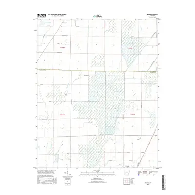
2017 Map of Risher
USGS Topo · Published 2017About this map
Weiner and the small community of Risher anchor this 2017 landscape where the drainage systems of the Arkansas Delta define the layout of the land. The terrain is characterized by a sophisticated network of canals and natural watercourses, including the wide Bayou De View and the engineered Long Pond Or Cache Ditch. These waterways, alongside features like Angle Ditch Lateral Number 4 and Farley Ditch, illustrate the intense agricultural management of the region, where once-wild bottomlands were converted into productive fields.
Find a feature on this map
59 named features on this map. Tap any name to fly to it.
Don’t see what you’re looking for? This feature index may not catch every label — zoom into the map to look around manually.
Map Details
Editions of this 2017 Risher Map
This is the sole edition of this map. No revisions or reprints were ever made.
Other maps of this area

1935 · Sedgwick
USGS Topo · 1:62,500

1935 · Alicia
USGS Topo · 1:62,500

1935 · Tuckerman
USGS Topo · 1:62,500

1939 · Weiner
USGS Topo · 1:62,500

1953 · Memphis
USGS Topo · 1:250,000

1956 · Memphis
USGS Topo · 1:250,000

1959 · Weiner
USGS Topo · 1:62,500

1959 · Sedgwick
USGS Topo · 1:62,500

1960 · Weiner
USGS Topo · 1:62,500
1960 · Sedgwick
USGS Topo · 1:62,500