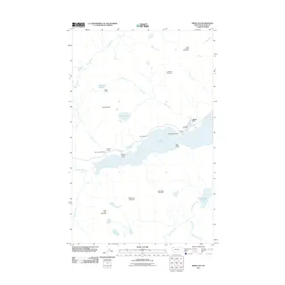
2011 Map of Rising Sun
USGS Topo · Published 2011About this map
Saint Mary Lake serves as the central anchor for this glaciated landscape, where the seasonal rhythms of the northern Rockies are evident in the network of peaks and drainages. The Rising Sun settlement and nearby Rising Sun Campground mark a primary point of human activity along the shoreline. Further west, the terrain rises sharply toward Goat Mountain and Mahtotopa Mountain, with the Going-to-the-Sun Point and Sunrift Gorge highlighting the geological formations carved by ice and water. This survey records the specific alignment of the mountain thoroughfare as it crosses the Baring Creek Bridge and navigates the steep topography near Baring Falls and Virginia Falls. The map also captures smaller, isolated landmarks such as Wild Goose Island and the curiously named Dead Horse Point, offering a precise view of the region's wilderness and tourism infrastructure in the early 21st century.
Find a feature on this map
34 named features on this map. Tap any name to fly to it.
Don’t see what you’re looking for? This feature index may not catch every label — zoom into the map to look around manually.
Map Details
Editions of this 2011 Rising Sun Map
This is the sole edition of this map. No revisions or reprints were ever made.
Other maps of this area

1901 · Browning
USGS Topo · 1:125,000

1903 · Browning
USGS Topo · 1:125,000

1904 · Chief Mountain
USGS Topo · 1:125,000

1938 · Chief Mountain
USGS Topo · 1:125,000

1960 · Cut Bank
USGS Topo · 1:250,000

1963 · Cut Bank
USGS Topo · 1:250,000

1964 · Cut Bank
USGS Topo · 1:250,000

1968 · Saint Mary
USGS Topo · 1:24,000

1968 · Babb
USGS Topo · 1:24,000
1968 · Cut Bank Pass
USGS Topo · 1:24,000