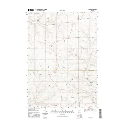
2016 Map of Rising Sun
USGS Topo · Published 2016About this map
Rising Sun and Liberty Pole anchor this portrait of the driftless region, where the Crawford and Vernon county line bisects a landscape defined by sharp ridges and deep valleys. The settlement pattern follows the high ground of Nash Ridge and Lennon Ridge, with farmsteads connected by a web of rural routes like Monument Rock Rd and Hinkst Hollow Rd. Topographic detail reveals the intricate drainage of Tainter Cr and Hornby Cr, which have carved out locally named features such as Hornby Hollow and Torgerson Hollow. Genealogists will find the location of the Towerville Cem near the small community of Towerville, providing a precise look at the historic centers of Crawford County before modern development. Notable landmarks like Monument Rock stand out among the various ridges, including Helgerson Ridge and Mickelson Ridge.
Find a feature on this map
90 named features on this map. Tap any name to fly to it.
Don’t see what you’re looking for? This feature index may not catch every label — zoom into the map to look around manually.
Map Details
Editions of this 2016 Rising Sun Map
This is the sole edition of this map. No revisions or reprints were ever made.
Other maps of this area

1903 · Waukon
USGS Topo · 1:125,000

1923 · Viroqua
USGS Topo · 1:62,500

1924 · Gays Mills
USGS Topo · 1:62,500

1926 · Gays Mills
USGS Topo · 1:62,500

1926 · Stoddard
USGS Topo · 1:62,500

1926 · Viroqua
USGS Topo · 1:62,500

1929 · Ferryville
USGS Topo · 1:62,500

1932 · Ferryville
USGS Topo · 1:62,500

1958 · La Crosse
USGS Topo · 1:250,000

1961 · La Crosse
USGS Topo · 1:250,000