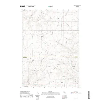
2018 Map of Rising Sun
USGS Topo · Published 2018About this map
Rising Sun and Liberty Pole anchor this ridge-top landscape along the border of Vernon and Crawford Counties. The topography is defined by narrow, winding ridges such as Nash Ridge, Lennon Ridge, and Mcmanus Ridge, which separate deep coulees and hollows like Hornby Hollow and Torgerson Hollow. This drainage pattern feeds into various watercourses, including Hornby Cr and the S Fork Sugar Cr. The settlement pattern follows the high ground, with crossroads like Fargo and Towerville serving as local hubs. The Towerville Cem and the natural landmark Monument Rock provide specific points of interest for those tracing family roots or local geography. The map illustrates a contemporary rural Wisconsin environment where the road network, including Co Rd B and numerous named local routes, strictly adheres to the challenging local relief.
Find a feature on this map
84 named features on this map. Tap any name to fly to it.
Don’t see what you’re looking for? This feature index may not catch every label — zoom into the map to look around manually.
Map Details
Editions of this 2018 Rising Sun Map
This is the sole edition of this map. No revisions or reprints were ever made.
Other maps of this area

1903 · Waukon
USGS Topo · 1:125,000

1923 · Viroqua
USGS Topo · 1:62,500

1924 · Gays Mills
USGS Topo · 1:62,500

1926 · Gays Mills
USGS Topo · 1:62,500

1926 · Stoddard
USGS Topo · 1:62,500

1926 · Viroqua
USGS Topo · 1:62,500

1929 · Ferryville
USGS Topo · 1:62,500

1932 · Ferryville
USGS Topo · 1:62,500

1958 · La Crosse
USGS Topo · 1:250,000

1961 · La Crosse
USGS Topo · 1:250,000