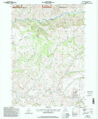
1995 Map of Ritter
USGS Topo · Published 1998About this map
Ritter Hot Springs and the nearby Ritter Pool serve as a focal point for this landscape in the mid-1990s, where the convergence of thermal activity and river geography shaped local settlement. The map captures the area around the Ritter Cem and a Gaging Sta along the Middle Fork John Day River, illustrating how the valley floor provided a narrow corridor for development beneath the looming height of Devils Backbone.
Find a feature on this map
35 named features on this map. Tap any name to fly to it.
Don’t see what you’re looking for? This feature index may not catch every label — zoom into the map to look around manually.
Map Details
Editions of this 1995 Ritter Map
This is the sole edition of this map. No revisions or reprints were ever made.
Other maps of this area

1950 · Ritter
USGS Topo · 1:62,500

1951 · Monument
USGS Topo · 1:62,500

1952 · Ritter
USGS Topo · 1:62,500

1953 · Pendleton
USGS Topo · 1:250,000

1955 · Canyon City
USGS Topo · 1:250,000

1956 · Pendleton
USGS Topo · 1:250,000

1959 · Canyon City
USGS Topo · 1:250,000

1969 · Lake Penland
USGS Topo · 1:24,000

1969 · Deerhorn Creek
USGS Topo · 1:24,000

1969 · Thompson Flat
USGS Topo · 1:24,000