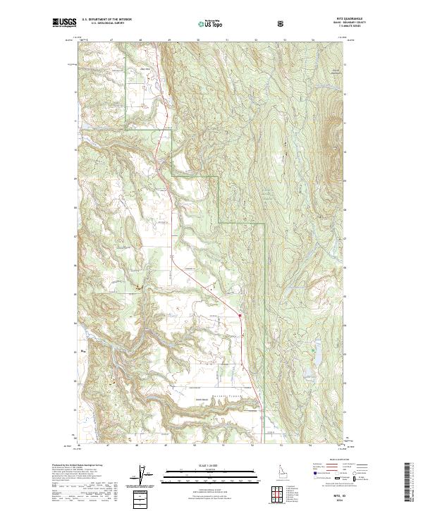
2024 Map of Ritz
USGS Topo · Published 2024About this map
Purcell Trench serves as the dominant geographical corridor in this part of Boundary County, Idaho, where the low-lying valley floor meets the rising slopes of the Purcell Mountains to the east. Small settlements such as Ritz and North Bench anchor the local road network, which is defined by rural routes like Fleming Creek Rd and Kings Row Rd. The eastern portion of the map is largely occupied by the Kaniksu National Forest, a terrain of dense contours and numerous water sources including Templeman Lake, Smith Lake, and Gable Spring. The drainage patterns are clearly visible through the courses of Meadow Creek and its many tributaries. This landscape transition from the open flats of Deer Park to the wooded mountain slopes reflects a region where timber and small-scale agriculture have long shaped the local economy and land use.
Find a feature on this map
61 named features on this map. Tap any name to fly to it.
Don’t see what you’re looking for? This feature index may not catch every label — zoom into the map to look around manually.
Map Details
Editions of this 2024 Ritz Map
This is the sole edition of this map. No revisions or reprints were ever made.
Other maps of this area

1911 · Priest Lake
USGS Topo · 1:250,000

1913 · Priest Lake
USGS Topo · 1:250,000

1958 · Sandpoint
USGS Topo · 1:250,000

1963 · Sandpoint
USGS Topo · 1:250,000

1965 · Meadow Creek
USGS Topo · 1:24,000

1965 · Farnham Peak
USGS Topo · 1:24,000

1965 · Eastport
USGS Topo · 1:24,000

1965 · Moravia
USGS Topo · 1:24,000

1965 · Ritz
USGS Topo · 1:24,000

1965 · Copeland
USGS Topo · 1:24,000