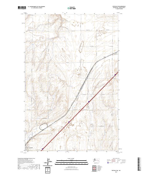
2023 Map of Ritzville NE
USGS Topo · Published 2023About this map
The northern reaches of Ritzville and the small settlement of Tokio anchor this 2023 map of the eastern Washington landscape. This quadrangle shows a transition from the structured residential blocks of the county seat, where streets like S Chelan St and S 4th Ave meet at the edge of town, to the expansive dryland farming and plateau country to the northeast. The terrain is marked by a network of rural routes named for local families and early settlers, including N Bauman Rd, N Sage Rd, and Rehn Rd.
Find a feature on this map
37 named features on this map. Tap any name to fly to it.
Don’t see what you’re looking for? This feature index may not catch every label — zoom into the map to look around manually.
Map Details
Editions of this 2023 Ritzville NE Map
This is the sole edition of this map. No revisions or reprints were ever made.
Other maps of this area

1953 · Ritzville
USGS Topo · 1:250,000

1959 · Ritzville
USGS Topo · 1:250,000

1964 · Karakul Hills
USGS Topo · 1:24,000

1964 · Marengo
USGS Topo · 1:24,000

1965 · Ritzville
USGS Topo · 1:250,000

1967 · Ritzville SW
USGS Topo · 1:24,000

1967 · Ritzville SE
USGS Topo · 1:24,000

1967 · Ritzville NE
USGS Topo · 1:24,000

1967 · Ritzville NW
USGS Topo · 1:24,000

1969 · Lamona
USGS Topo · 1:24,000