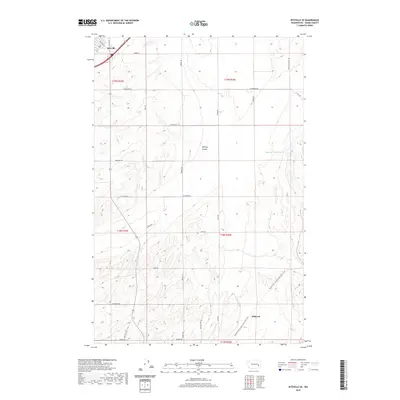
2020 Map of Ritzville SE
USGS Topo · Published 2020About this map
Ritzville serves as the focal point in the northwestern corner of this Adams County landscape, where the town's grid meets a vast network of rural section-line roads. The terrain is defined by the distinct northwest-southeast orientation of the Channeled Scablands, evidenced by the drainage patterns of McElroy Coulee and Cow Cr. This contemporary survey highlights the repurposing of historic transportation corridors, most notably the Palouse To Cascades State Park Trail which follows a decommissioned rail bed across the southern half of the map near Hillcrest. Agricultural land use is punctuated by water management features like Sheep Springs Reservoir, while family-named thoroughfares such as Leisle Rd and Richards Rd provide a clear connection to the area's homesteading heritage and local landownership patterns.
Find a feature on this map
31 named features on this map. Tap any name to fly to it.
Don’t see what you’re looking for? This feature index may not catch every label — zoom into the map to look around manually.
Map Details
Editions of this 2020 Ritzville SE Map
This is the sole edition of this map. No revisions or reprints were ever made.
Other maps of this area

1923 · Washtucna
USGS Topo · 1:62,500

1925 · Washtucna
USGS Topo · 1:62,500

1950 · Benge
USGS Topo · 1:62,500

1952 · Benge
USGS Topo · 1:62,500

1953 · Walla Walla
USGS Topo · 1:250,000

1953 · Ritzville
USGS Topo · 1:250,000

1958 · Walla Walla
USGS Topo · 1:250,000

1959 · Ritzville
USGS Topo · 1:250,000

1964 · Karakul Hills
USGS Topo · 1:24,000

1964 · Marengo
USGS Topo · 1:24,000