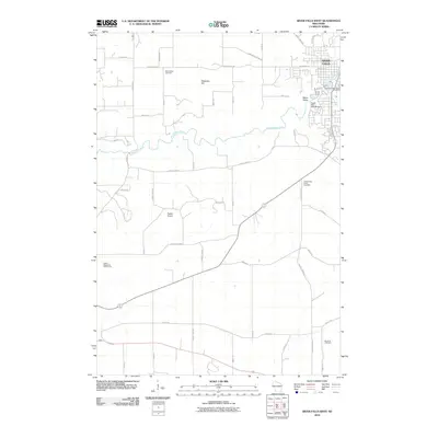
2010 Map of River Falls West
USGS Topo · Published 2010About this map
The Kinnickinnic River carves a winding path through this western Wisconsin landscape, anchoring the development of River Falls and its surrounding rural townships. The river's industrial and hydroelectric legacy is visible through structures like the Junction Falls Dam and Powell Falls 2WP180 Dam near the town center. Outside the municipal limits, the map reveals a well-organized agricultural grid punctuated by local landmarks such as Melander Hill and the Tegeler Airport. Genealogy and local history researchers will find several significant burial sites, including Mann Valley Cemetery in the north and the Big River Cemetery further south near the banks of the Big River. The transition from urban streets to rural county highways, such as County Hwy-MM, illustrates the region's balance between residential growth and its longstanding farming heritage.
Find a feature on this map
44 named features on this map. Tap any name to fly to it.
Don’t see what you’re looking for? This feature index may not catch every label — zoom into the map to look around manually.
Map Details
Editions of this 2010 River Falls West Map
This is the sole edition of this map. No revisions or reprints were ever made.
Other maps of this area

1944 · Red Wing
USGS Topo · 1:62,500

1946 · Hudson
USGS Topo · 1:62,500

1946 · River Falls
USGS Topo · 1:62,500

1949 · River Falls
USGS Topo · 1:62,500

1949 · Hudson
USGS Topo · 1:62,500

1949 · Hudson
USGS Topo · 1:24,000

1950 · Hudson
USGS Topo · 1:24,000

1951 · Prescott
USGS Topo · 1:24,000

1952 · Red Wing
USGS Topo · 1:62,500

1953 · Saint Paul
USGS Topo · 1:250,000