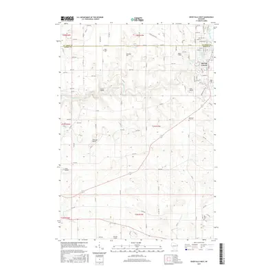
2015 Map of River Falls West
USGS Topo · Published 2015About this map
The Kinnickinnic River winds through the heart of this landscape, its path defined by significant elevation changes and the presence of several distinctive geological formations. Near the western edge of River Falls, the waterway creates the Upper Kinnickinnic Pond and Lower Kinnickinnic Pond, providing a central focal point for the settlement. The surrounding terrain is marked by prominent high points such as Ashbaugh Mound, Lone Mound, and Yorks Mound, which rise above the agricultural valley floors. Local history is anchored by rural communities and burial grounds including Clifton Hollow, Mann Valley, and Saint Bridget Cem. This survey illustrates the spatial relationship between the developing outskirts of River Falls and the established farmsteads of the Mann Valley area, bordered to the south by the drainage of the Big River and Dry Run Coulee.
Find a feature on this map
74 named features on this map. Tap any name to fly to it.
Don’t see what you’re looking for? This feature index may not catch every label — zoom into the map to look around manually.
Map Details
Editions of this 2015 River Falls West Map
This is the sole edition of this map. No revisions or reprints were ever made.
Other maps of this area

1944 · Red Wing
USGS Topo · 1:62,500

1946 · Hudson
USGS Topo · 1:62,500

1946 · River Falls
USGS Topo · 1:62,500

1949 · River Falls
USGS Topo · 1:62,500

1949 · Hudson
USGS Topo · 1:62,500

1949 · Hudson
USGS Topo · 1:24,000

1950 · Hudson
USGS Topo · 1:24,000

1951 · Prescott
USGS Topo · 1:24,000

1952 · Red Wing
USGS Topo · 1:62,500

1953 · Saint Paul
USGS Topo · 1:250,000