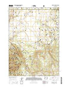
2014 Map of Riverbed Butte
USGS Topo · Published 2014About this map
Sycan Flat and the high elevations of Riverbed Butte dominate this section of the Fremont National Forest along the border of Lake and Klamath counties. The landscape is defined by a dense network of forest development roads, including Nat For Dev Rd 3312 and Nat For Dev Rd 3239, which provide access to the area's numerous water sources. Drainages such as Shake Cr, Merritt Cr, and Evans Cr carve through the terrain, feeding into locations like Klipple Lake. This 2014 survey documents the persistence of the OC&E Woods Line State Trl, a recreational conversion of the historic Oregon, California and Eastern Railway line. Small water points like Packsaddle Spring and Small Spring are also noted, providing critical landmarks for those navigating these high-country woods.
Find a feature on this map
24 named features on this map. Tap any name to fly to it.
Don’t see what you’re looking for? This feature index may not catch every label — zoom into the map to look around manually.
Map Details
Editions of this 2014 Riverbed Butte Map
This is the sole edition of this map. No revisions or reprints were ever made.
Other maps of this area

1889 · Klamath
USGS Topo · 1:250,000

1894 · Klamath
USGS Topo · 1:250,000

1955 · Klamath Falls
USGS Topo · 1:250,000

1958 · Klamath Falls
USGS Topo · 1:250,000

1960 · Riverbed Butte
USGS Topo · 1:62,500

1960 · Sycan Marsh
USGS Topo · 1:62,500

1966 · Shake Butte
USGS Topo · 1:24,000

1966 · Sandhill Crossing
USGS Topo · 1:24,000

1966 · Pole Butte
USGS Topo · 1:24,000

1974 · Lake Abert
USGS Topo · 1:100,000