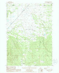
1988 Map of Riverbed Butte
USGS Topo · Published 1988About this map
Fremont National Forest defines the southern and western portions of this high-altitude landscape, where the Old Indian Treaty Boundary marks a historical administrative line across the terrain. The northern section is characterized by the wide expanse of Sycan Flat, a region dotted with numerous stock ponds and springs that supported the local ranching economy. Rising above the southern drainage of Fivemile Creek and Evans Creek, the prominent landform of Riverbed Butte anchors the topography near the Horse Grade. Remote outposts and water sources like Dicks Well and Packsaddle Spring provide evidence of land use in this rugged intersection of Lake and Klamath Counties, while a Cinder Pit near Merritt Creek suggests localized extractive activity.
Find a feature on this map
26 named features on this map. Tap any name to fly to it.
Don’t see what you’re looking for? This feature index may not catch every label — zoom into the map to look around manually.
Map Details
Editions of this 1988 Riverbed Butte Map
This is the sole edition of this map. No revisions or reprints were ever made.
Other maps of this area

1889 · Klamath
USGS Topo · 1:250,000

1894 · Klamath
USGS Topo · 1:250,000

1955 · Klamath Falls
USGS Topo · 1:250,000

1958 · Klamath Falls
USGS Topo · 1:250,000

1960 · Riverbed Butte
USGS Topo · 1:62,500

1960 · Sycan Marsh
USGS Topo · 1:62,500

1966 · Shake Butte
USGS Topo · 1:24,000

1966 · Sandhill Crossing
USGS Topo · 1:24,000

1966 · Pole Butte
USGS Topo · 1:24,000

1974 · Lake Abert
USGS Topo · 1:100,000