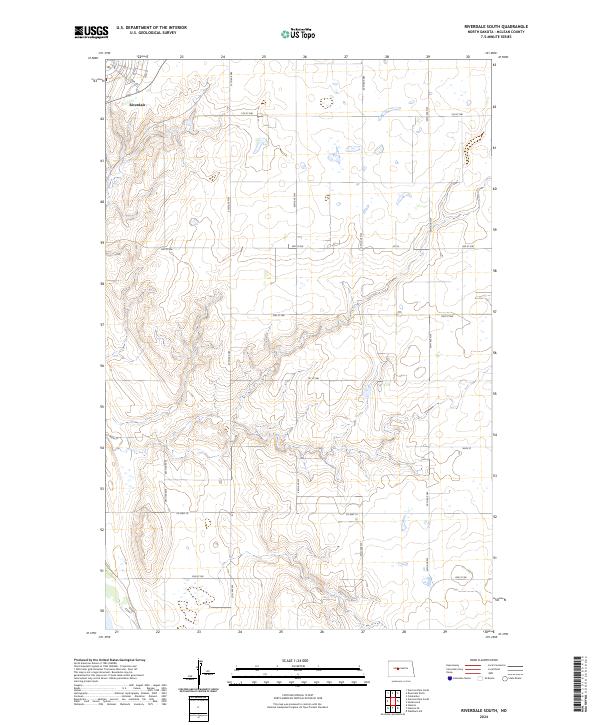
2024 Map of Riverdale South
USGS Topo · Published 2024About this map
Riverdale occupies the northwestern corner of this McLean County survey, where a residential grid of streets like Iowa Ave and 10th St meets the open prairie. The landscape is defined by the Public Land Survey System, with the terrain divided between t146n r84w and t146n r83w to the north and t145n r84w and t145n r83w to the south. This modern survey illustrates how decades of land management have structured the region into a precise network of section lines and gravel roads, including 37th Ave NW and 35th Ave NW. Beyond the town, the topography is marked by numerous small depressions and ephemeral wetlands characteristic of the North Dakota plains, interconnected by local thoroughfares such as Co Hwy 14 and Co Hwy 16.
Find a feature on this map
26 named features on this map. Tap any name to fly to it.
Don’t see what you’re looking for? This feature index may not catch every label — zoom into the map to look around manually.
Map Details
Editions of this 2024 Riverdale South Map
This is the sole edition of this map. No revisions or reprints were ever made.
Other maps of this area

1922 · Garrison
USGS Topo · 1:62,500

1929 · Coleharbor
USGS Topo · 1:62,500

1948 · Stanton
USGS Topo · 1:62,500

1949 · Stanton
USGS Topo · 1:62,500

1949 · Washburn
USGS Topo · 1:62,500

1954 · McClusky
USGS Topo · 1:250,000

1958 · McClusky
USGS Topo · 1:250,000

1961 · Underwood
USGS Topo · 1:24,000

1967 · Washburn SW
USGS Topo · 1:24,000

1967 · Stanton SE
USGS Topo · 1:24,000