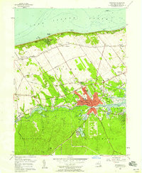
1956 Map of Riverhead
USGS Topo · Published 1958About this map
Riverhead stands as the central hub of eastern Long Island in this mid-century survey, situated where the Peconic River transitions into the bay. The town's grid is well-defined, containing essential community landmarks like the Central Suffolk Hosp, St Isidores Ch, and the Mercy High Sch. Outside the developed center, the landscape is a mix of agricultural plots and industrial markers, including the Riverhead Raceway and a prominent Drive-in Theater to the southeast.
Find a feature on this map
80 named features on this map. Tap any name to fly to it.
Don’t see what you’re looking for? This feature index may not catch every label — zoom into the map to look around manually.
Map Details
Editions of this 1956 Riverhead Map
3 editions found
Other maps of this area

1903 · Riverhead
USGS Topo · 1:62,500

1904 · Riverhead
USGS Topo · 1:62,500

1904 · Moriches
USGS Topo · 1:62,500

1943 · Riverhead
USGS Topo · 1:62,500

1947 · Mattituck
USGS Topo · 1:24,000

1947 · Mattituck Hills
USGS Topo · 1:24,000

1947 · Riverhead
USGS Topo · 1:24,000

1947 · Quogue
USGS Topo · 1:24,000

1947 · Eastport
USGS Topo · 1:24,000

1947 · Hartford
USGS Topo · 1:250,000