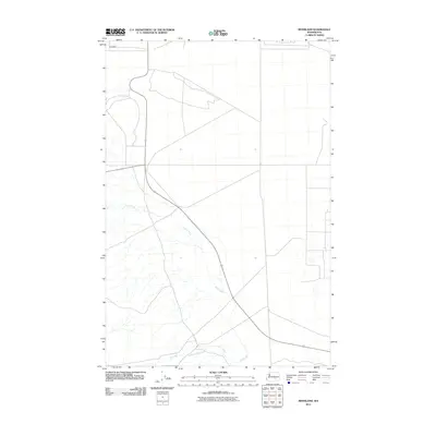
2011 Map of Riverland
USGS Topo · Published 2011About this map
Riverland serves as the primary focal point of this arid Washington landscape, situated along the northern reach of the survey area. The terrain is defined by a series of intermittent and ephemeral watercourses that reveal the natural drainage patterns of this high desert environment. Cold Creek dominates the central portion of the map, carving a diagonal path from the northwest toward the southeast. This drainage system is augmented by Dry Creek and Rattlesnake Creek in the south, which converge in a network of seasonal washes. The sparse distribution of named settlements emphasizes the rural and utilitarian nature of the land, where the infrastructure is largely composed of long, straight roadways and specialized facilities that reflect the industrial and agricultural requirements of the region during the early 21st century.
Find a feature on this map
4 named features on this map. Tap any name to fly to it.
Don’t see what you’re looking for? This feature index may not catch every label — zoom into the map to look around manually.
Map Details
Editions of this 2011 Riverland Map
This is the sole edition of this map. No revisions or reprints were ever made.
Other maps of this area

1915 · Prosser
USGS Topo · 1:125,000

1916 · Coyote Rapids
USGS Topo · 1:62,500

1917 · Priest Rapids
USGS Topo · 1:62,500

1917 · Prosser
USGS Topo · 1:125,000

1948 · Emerson Nipple
USGS Topo · 1:24,000

1950 · Grandview
USGS Topo · 1:62,500

1951 · Priest Rapids
USGS Topo · 1:62,500

1951 · Grandview
USGS Topo · 1:62,500

1951 · Corral Canyon
USGS Topo · 1:62,500

1951 · Coyote Rapids
USGS Topo · 1:62,500