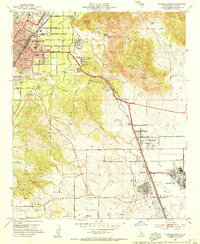
1953 Map of Riverside East
USGS Topo · Published 1955About this map
March Air Force Base dominates the southeastern quadrant of this 1950s landscape, flanked by housing at Arnold Heights and West March. The expansion of Inland Southern California is visible in the burgeoning residential tracts of Belvedere Heights and Canyon Crest Heights, while the newly established University of California at Riverside takes root at the foot of the Box Springs Mountains. This era shows a complex transit network where the Pacific Electric and Atchison Topeka and Santa Fe rail lines intersect the growing grid of Riverside. Irrigation infrastructure remains critical to the region's character, evidenced by the Gage Canal and Riverside Canal winding through the terrain. Local education is well-represented through numerous neighborhood landmarks, including Lincoln Sch, Irving Sch, and Lowell Sch.
Find a feature on this map
40 named features on this map. Tap any name to fly to it.
Don’t see what you’re looking for? This feature index may not catch every label — zoom into the map to look around manually.
Map Details
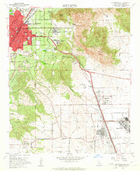
Editions of this 1953 Riverside East Map
2 editions found
Other maps of this area

1896 · San Bernardino
USGS Topo · 1:62,500

1898 · San Bernardino
USGS Topo · 1:62,500

1899 · Redlands
USGS Topo · 1:62,500

1901 · Southern California Sheet No. 1
USGS Topo · 1:250,000

1901 · San Bernardino
USGS Topo · 1:62,500

1901 · Redlands
USGS Topo · 1:62,500

1901 · Elsinore
USGS Topo · 1:125,000

1901 · Riverside
USGS Topo · 1:62,500

1904 · Southern California Sheet No. 1
USGS Topo · 1:250,000
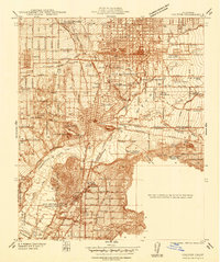
1938 · Colton
USGS Topo · 1:31,680