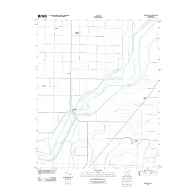
2011 Map of Rivervale
USGS Topo · Published 2011About this map
The Right Hand Chute Little River and Left Hand Chute of Little River dominate this Northeast Arkansas landscape, carving complex channels through the alluvial plain. The engineering of the land is evident in the dense network of drainage canals, such as Ditch Number 53 and Ditch Number 4, which were vital for agricultural development in the Mississippi Embayment. Small communities and rail stops like Rivervale, Stier, and West Ridge align with the Burlington Northern Santa Fe tracks, reflecting the historical importance of the railroad in moving timber and crops from this fertile delta. Local history is anchored by sites like Hawkins Cemetery near Helfer Landing, while unique geographic features like Old River Island indicate the shifting nature of the river's path over time. This 2011 survey records a landscape where water management and transportation routes define the settlement patterns of the region.
Find a feature on this map
64 named features on this map. Tap any name to fly to it.
Don’t see what you’re looking for? This feature index may not catch every label — zoom into the map to look around manually.
Map Details
Editions of this 2011 Rivervale Map
This is the sole edition of this map. No revisions or reprints were ever made.
Other maps of this area

1939 · Evadale
USGS Topo · 1:62,500

1941 · Leachville
USGS Topo · 1:62,500

1941 · Manila
USGS Topo · 1:62,500

1941 · Marked Tree
USGS Topo · 1:62,500

1953 · Memphis
USGS Topo · 1:250,000

1956 · Leachville
USGS Topo · 1:62,500

1956 · Manila
USGS Topo · 1:62,500

1956 · Evadale
USGS Topo · 1:62,500

1956 · Marked Tree
USGS Topo · 1:62,500

1956 · Memphis
USGS Topo · 1:250,000