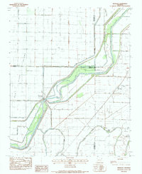
1983 Map of Rivervale
USGS Topo · Published 1984About this map
Little River and its intricate distributary system dominate this mid-century Northeast Arkansas landscape, where the Right Hand Chute of Little River and Left Hand Chute of Little River carve through the alluvial plains of Poinsett County. This survey reveals a region defined by extensive drainage engineering, with a dense network of canals such as Ditch No 12 and Diversion Ditch designed to manage the bottomlands. The small settlement of Rivervale serves as a central point near the Dillard Cutoff, while rural life is anchored by landmarks like Buffalo Ch, Caraway Ch, and the County Sch at West Ridge. The map illustrates the transition from the natural winding course of the Old River to a highly managed agricultural environment, evidenced by the numerous spoil banks and named ditches that crisscross the territory between Stier and Bondsville.
Find a feature on this map
32 named features on this map. Tap any name to fly to it.
Don’t see what you’re looking for? This feature index may not catch every label — zoom into the map to look around manually.
Map Details
Editions of this 1983 Rivervale Map
This is the sole edition of this map. No revisions or reprints were ever made.
Other maps of this area

1939 · Evadale
USGS Topo · 1:62,500

1941 · Leachville
USGS Topo · 1:62,500

1941 · Manila
USGS Topo · 1:62,500

1941 · Marked Tree
USGS Topo · 1:62,500

1953 · Memphis
USGS Topo · 1:250,000

1956 · Leachville
USGS Topo · 1:62,500

1956 · Manila
USGS Topo · 1:62,500

1956 · Evadale
USGS Topo · 1:62,500

1956 · Marked Tree
USGS Topo · 1:62,500

1956 · Memphis
USGS Topo · 1:250,000