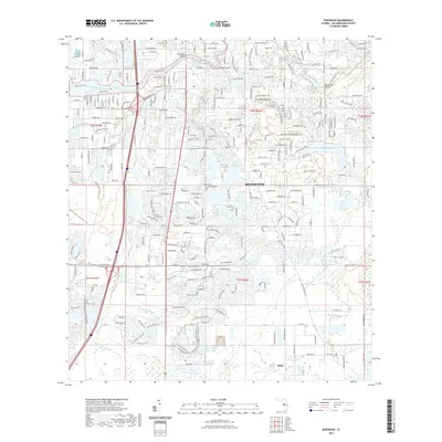
2021 Map of Riverview
USGS Topo · Published 2021About this map
The Alafia River flows westward through the heart of this Hillsborough County landscape, serving as a primary corridor for the community of Riverview. The waterway is spanned by the Riverview Bridge and Bell Shoals Bridge, connecting residential developments that have increasingly filled the spaces between historic landmarks like the Samford Cem. To the south, the terrain transitions toward the smaller settlement of Balm, surrounded by an extensive network of conservation lands including the Alafia Scrub Preserve Trl and the Balm Boyette Scrub Trl.
Find a feature on this map
253 named features on this map. Tap any name to fly to it.
Don’t see what you’re looking for? This feature index may not catch every label — zoom into the map to look around manually.
Map Details
Editions of this 2021 Riverview Map
This is the sole edition of this map. No revisions or reprints were ever made.
Other maps of this area

1921 · Tampa
USGS Topo · 1:62,500

1944 · Mango
USGS Topo · 1:31,680

1944 · Ruskin
USGS Topo · 1:31,680

1944 · Tampa
USGS Topo · 1:31,680

1944 · Wimauma
USGS Topo · 1:31,680

1944 · Balm
USGS Topo · 1:31,680

1945 · Gadsden Point
USGS Topo · 1:31,680
1947 · Tampa
USGS Topo · 1:25,000

1947 · Ruskin
USGS Topo · 1:25,000

1947 · Wimauma
USGS Topo · 1:25,000