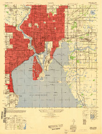
1947 Map of Tampa
USGS Topo · Published 1947About this map
Ybor City stands as the historic industrial heart of the region, its dense street grid defined by the Seaboard Air Line and Atlantic Coast Line railroads. The waterfront is a complex of maritime infrastructure, where the Garrison Channel, Seddon Channel, and Ybor Channel carve around Seddon Island and Hooker Point. This 1940s landscape shows a city transitioning from its cigar-manufacturing roots toward modern aviation and industrial shipping, evidenced by the Peter O Knight Municipal Airport at the tip of Davis Islands.
Find a feature on this map
86 named features on this map. Tap any name to fly to it.
Don’t see what you’re looking for? This feature index may not catch every label — zoom into the map to look around manually.
Map Details
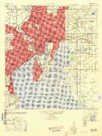
Editions of this 1947 Tampa Map
2 editions found
Other maps of this area

1921 · Tampa
USGS Topo · 1:62,500

1921 · St Petersburg
USGS Topo · 1:62,500

1943 · Gandy Bridge
USGS Topo · 1:31,680

1943 · Port Tampa
USGS Topo · 1:31,680

1943 · Thonotosassa
USGS Topo · 1:24,000

1944 · Sulphur Springs
USGS Topo · 1:31,680

1944 · Mango
USGS Topo · 1:31,680

1944 · Tampa
USGS Topo · 1:31,680

1944 · Thonotosassa
USGS Topo · 1:31,680

1944 · Balm
USGS Topo · 1:31,680