
1950 Map of Rives
USGS Topo · Published 1970About this map
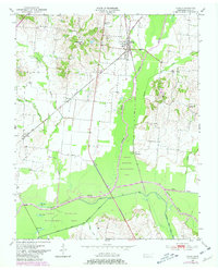
Rives serves as the focal point of this mid-century West Tennessee landscape, situated at the critical junction where the Gulf Mobile and Ohio and Illinois Central railroads intersect. The local economy and geography are heavily influenced by the winding course of the Obion River and its various branches, including the Fork North Obion River and the Rutherford Fork Obion River. A complex network of water management is visible through a prominent drainage canal and the presence of several oxbow features such as Horseshoe Lake, Long Lake, and Big Lake.
Find a feature on this map
25 named features on this map. Tap any name to fly to it.
Don’t see what you’re looking for? This feature index may not catch every label — zoom into the map to look around manually.
Map Details
Editions of this 1950 Rives Map
2 editions found
Other maps of this area

1950 · Obion
USGS Topo · 1:24,000

1951 · Obion
USGS Topo · 1:24,000

1951 · Rives
USGS Topo · 1:24,000

1954 · Rutherford
USGS Topo · 1:24,000

1954 · Union City
USGS Topo · 1:24,000

1956 · Gardner
USGS Topo · 1:24,000

1956 · Harris
USGS Topo · 1:24,000

1956 · Dyersburg
USGS Topo · 1:250,000
1965 · Kenton
USGS Topo · 1:24,000
1965 · Trimble
USGS Topo · 1:24,000