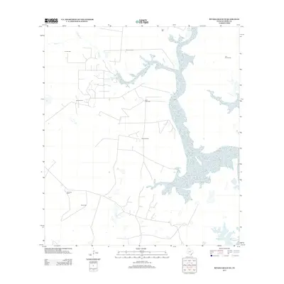
2013 Map of Riviera Beach NE
USGS Topo · Published 2013About this map
The coastal scrub and ranchlands of Kleberg County are defined by an intricate network of named water wells and seasonal drainages leading toward the Laguna Madre. Jaboncillos Ranch serves as a primary point of human settlement in this landscape, where the naming of individual wells like Noria Maria Well, Huisache Well, and Zacahuistle Well reveals a history of land use centered on water access in a semi-arid environment. The hydrological character of the region is further marked by the sprawling reaches of Cayo del Hinojo and Little Tule Lake, which receive intermittent flow from creeks such as Tunas Cr and Chiltipin Cr. This survey illustrates the spatial distribution of resource extraction and livestock management, where identified points like Field Fourteen Well and Esquina Well provide crucial landmarks for local history and land tenure studies.
Find a feature on this map
13 named features on this map. Tap any name to fly to it.
Don’t see what you’re looking for? This feature index may not catch every label — zoom into the map to look around manually.
Map Details
Editions of this 2013 Riviera Beach NE Map
This is the sole edition of this map. No revisions or reprints were ever made.
Other maps of this area

1924 · Petronilla
USGS Topo · 1:62,500

1925 · Oso Creek
USGS Topo · 1:62,500

1928 · Sarita
USGS Topo · 1:125,000

1950 · Corpus Christi
USGS Topo · 1:250,000

1951 · South Bird Island NW
USGS Topo · 1:24,000

1951 · Point Of Rocks
USGS Topo · 1:24,000

1951 · Kleberg Point
USGS Topo · 1:24,000

1951 · Riviera Beach NE
USGS Topo · 1:24,000

1951 · Oso Creek
USGS Topo · 1:62,500

1951 · South Bird Island
USGS Topo · 1:62,500