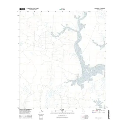
2016 Map of Riviera Beach NE
USGS Topo · Published 2016About this map
Chiltipin Cr and Tunas Cr define the hydrological landscape of this coastal Texas region in Kleberg County. The terrain is characterized by a high density of wetlands as identified by the FWS National Wetlands Inventory, illustrating the subtle drainage patterns that feed into the Laguna Madre system. The sparse naming of features on this map highlights the expansive, undeveloped nature of the local environment during this 2016 period, where narrow creeks and ephemeral water bodies dictate the layout of the land and any accompanying rural routes.
Find a feature on this map
2 named features on this map. Tap any name to fly to it.
Don’t see what you’re looking for? This feature index may not catch every label — zoom into the map to look around manually.
Map Details
Editions of this 2016 Riviera Beach NE Map
This is the sole edition of this map. No revisions or reprints were ever made.
Other maps of this area

1924 · Petronilla
USGS Topo · 1:62,500

1925 · Oso Creek
USGS Topo · 1:62,500

1928 · Sarita
USGS Topo · 1:125,000

1950 · Corpus Christi
USGS Topo · 1:250,000

1951 · South Bird Island NW
USGS Topo · 1:24,000

1951 · Point Of Rocks
USGS Topo · 1:24,000

1951 · Kleberg Point
USGS Topo · 1:24,000

1951 · Riviera Beach NE
USGS Topo · 1:24,000

1951 · Oso Creek
USGS Topo · 1:62,500

1951 · South Bird Island
USGS Topo · 1:62,500