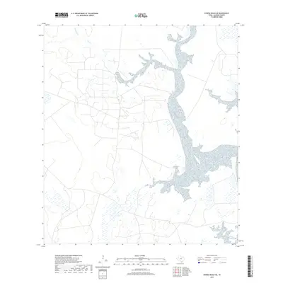
2019 Map of Riviera Beach NE
USGS Topo · Published 2019About this map
The coastal plains of Kleberg County are defined by a complex network of estuarine waters and seasonal drainages. The landscape is dominated by the confluence of major tidal inlets, where the brackish waters of Chittipin Cr and Tunas Cr feed into a broad, branching bay system. This 2019 survey documents the intricate shoreline and surrounding wetlands of the Texas Gulf Coast, illustrating the intersection of low-lying brush country and significant marine inlets. The lack of concentrated urban development highlights a region primarily shaped by environmental factors and extensive land holdings, making it a critical reference for understanding the modern geomorphology and hydrology of this section of the Baffin Bay watershed.
Find a feature on this map
2 named features on this map. Tap any name to fly to it.
Don’t see what you’re looking for? This feature index may not catch every label — zoom into the map to look around manually.
Map Details
Editions of this 2019 Riviera Beach NE Map
This is the sole edition of this map. No revisions or reprints were ever made.
Other maps of this area

1924 · Petronilla
USGS Topo · 1:62,500

1925 · Oso Creek
USGS Topo · 1:62,500

1928 · Sarita
USGS Topo · 1:125,000

1950 · Corpus Christi
USGS Topo · 1:250,000

1951 · South Bird Island NW
USGS Topo · 1:24,000

1951 · Point Of Rocks
USGS Topo · 1:24,000

1951 · Kleberg Point
USGS Topo · 1:24,000

1951 · Riviera Beach NE
USGS Topo · 1:24,000

1951 · Oso Creek
USGS Topo · 1:62,500

1951 · South Bird Island
USGS Topo · 1:62,500