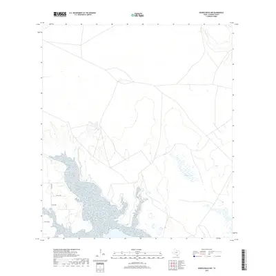
2019 Map of Riviera Beach NW
USGS Topo · Published 2019About this map
Madero Lake and the surrounding coastal wetlands of Kleberg County define this low-lying landscape along the Texas Gulf Coast. The terrain is characterized by a network of ephemeral watercourses and salt marshes, including Pinto Cr to the west and Tunas Cr at the northeastern corner. This 2019 survey shows a sparsely populated area where the primary human footprint consists of a rectilinear grid of rural roads such as Co RD 2220e and Co RD 2180. These routes provide access through the open terrain, linking isolated coastal points to the inland infrastructure. The map's contour intervals highlight the subtle elevation changes of the coastal plain, revealing how the water levels of the Gulf dictate the local geography and drainage patterns of these tidal flats.
Find a feature on this map
7 named features on this map. Tap any name to fly to it.
Don’t see what you’re looking for? This feature index may not catch every label — zoom into the map to look around manually.
Map Details
Editions of this 2019 Riviera Beach NW Map
This is the sole edition of this map. No revisions or reprints were ever made.
Other maps of this area

1924 · Petronilla
USGS Topo · 1:62,500

1928 · Sarita
USGS Topo · 1:125,000

1950 · Corpus Christi
USGS Topo · 1:250,000

1951 · Kleberg Point
USGS Topo · 1:24,000

1951 · Riviera Beach NE
USGS Topo · 1:24,000

1952 · Riviera Beach
USGS Topo · 1:24,000

1952 · Riviera Beach NW
USGS Topo · 1:24,000

1952 · Riviera Beach
USGS Topo · 1:62,500

1954 · Kingsville
USGS Topo · 1:62,500

1954 · Petronila
USGS Topo · 1:62,500