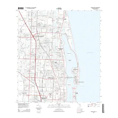
2015 Map of Riviera Beach
USGS Topo · Published 2015About this map
Riviera Beach and Palm Beach Gardens anchor this coastal Florida landscape, where the Atlantic shoreline meets a complex network of lagoons and canals. The Intracoastal Waterway serves as a central artery, separating the mainland from barrier islands like Singer Island and Munyon Island. This 2015 survey illustrates the dense residential and educational development of the northern Palm Beach area, including the satellite campus of Florida Atlantic University and specialized communities such as Palm Beach Shores and North Palm Beach. Engineering features like the Parker Bridge and Riviera Beach Bridge provide vital links across Lake Worth, while the Entrance Channel near Peanut Island facilitates maritime access to the sea. The map also delineates the northern reach of West Palm Beach and the enclave of Mangonia Park, reflecting the continuous urban fabric of the Gold Coast.
Find a feature on this map
40 named features on this map. Tap any name to fly to it.
Don’t see what you’re looking for? This feature index may not catch every label — zoom into the map to look around manually.
Map Details
Editions of this 2015 Riviera Beach Map
This is the sole edition of this map. No revisions or reprints were ever made.
Other maps of this area

1945 · Delta
USGS Topo · 1:24,000

1946 · Riviera Beach
USGS Topo · 1:24,000

1946 · Palm Beach Farms
USGS Topo · 1:24,000

1946 · Palm Beach
USGS Topo · 1:24,000

1948 · Rood
USGS Topo · 1:24,000

1948 · Jupiter
USGS Topo · 1:24,000

1949 · Rood
USGS Topo · 1:24,000

1949 · Palm Beach Farms
USGS Topo · 1:24,000

1949 · Riviera Beach
USGS Topo · 1:24,000

1950 · Jupiter
USGS Topo · 1:24,000