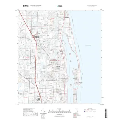
2021 Map of Riviera Beach
USGS Topo · Published 2021About this map
Lake Worth defines the coastal geography of this Palm Beach County corridor, separating the mainland settlements from the developed barrier beaches of Singer Island. The landscape is a dense network of residential communities and institutional hubs, from Cabana Colony in the north to the busy environs of West Palm Beach and Mangonia Park in the south. The maritime character of the region is evident in the Intracoastal Waterway and the Lake Worth Inlet, which provides access to the Atlantic Ocean via the Entrance Channel.
Find a feature on this map
44 named features on this map. Tap any name to fly to it.
Don’t see what you’re looking for? This feature index may not catch every label — zoom into the map to look around manually.
Map Details
Editions of this 2021 Riviera Beach Map
This is the sole edition of this map. No revisions or reprints were ever made.
Other maps of this area

1945 · Delta
USGS Topo · 1:24,000

1946 · Riviera Beach
USGS Topo · 1:24,000

1946 · Palm Beach Farms
USGS Topo · 1:24,000

1946 · Palm Beach
USGS Topo · 1:24,000

1948 · Rood
USGS Topo · 1:24,000

1948 · Jupiter
USGS Topo · 1:24,000

1949 · Rood
USGS Topo · 1:24,000

1949 · Palm Beach Farms
USGS Topo · 1:24,000

1949 · Riviera Beach
USGS Topo · 1:24,000

1950 · Jupiter
USGS Topo · 1:24,000